T30 UHF Receiver
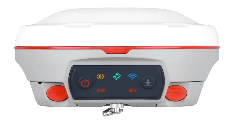
T30 IMU GNSS Receiver is an ultra-compact full-constellation RTK receiver with built-in IMU tilt compensation and 4G/WiFi/UHF connectivity, delivering fast centimeter-level positioning for demanding survey tasks.
Introduction
Experience Precise Infrastructure Sensing with the T30 Choke Ring Antenna
Featuring multi-constellation tracking with L-Band and PPP support, calibration-free IMU tilt compensation up to 60°, and integrated 4G/WiFi/Bluetooth plus UHF modem in a rugged IP67 magnesium-alloy housing, the T30 IMU GNSS receiver works seamlessly with Android-based Survey Master to provide an intuitive, high-efficiency workflow for professional land surveying and GIS projects.
Innovative
Explore the Technical Specifications of Satellite Antenna
Characteristics:
- Type: UHF, GNSS, GPS, GLONASS, Galileo
- Applications: tracking
- Other features: compact
Overview
With full-constellation tracking, tilt compensation, 4G/WiFi/Bluetooth® connectivity, and an easy workflow with Android-based Survey Master, the T30 GNSS receiver is one of the most reliable choices for demanding surveying tasks.
Technical Capabilities
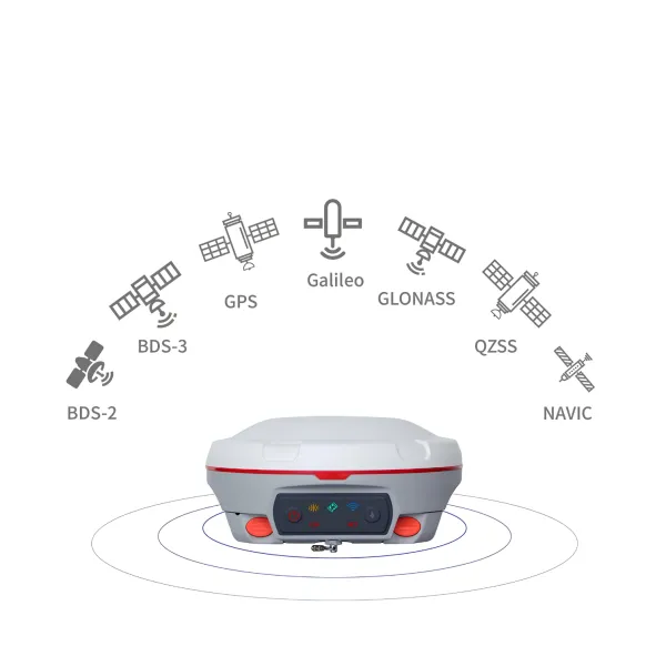
GPS L1/L2/L5, BeiDou B1/B2/B3, GLONASS L1/L2, Galileo E1/E5a/E5b, SBAS, QZSS, IRNSS.
BeiDou global signals B1C and B2a.
Integrated WiFi / UHF / 4G module.
Tilt compensation.
Two hot-swappable 3400 mAh batteries.
Low power consumption.
Supports L-Band and PPP.
Constellation and Compatibility
Tracks all current and planned global GNSS constellations, plus L-Band.
Designed to work seamlessly with Android-based Survey Master, including the Survey Master Wizard workflow.
Rugged Design
Extremely compact form factor for easy field use.
Hot-swappable dual-battery design supports continuous operation in the field.
High Performance
Tilt compensation (up to 30°) helps collect high-accuracy data faster on site.
Survey Master Wizard workflow improves productivity for both beginner and professional surveyors.
Product parameter
Cutting edge innovative technical characteristics
1198
GPS: L1C/A, L1C, L2P, L2C, L5
BDS: B1l, B2l, B3l, B1C, B2a, B2b
GLONASS: G1, G2, G3
Galileo: E1, E5a, E5b, E6c, E5 AItBOC
QZSS: L1C/A, L2C, L5, L1C
IRNSS: L5
SBAS: L1C/A
<1.5 s
<50 s
<30 s
<15 s
<10s
>99.9%
Horizontal 2.5 mm + 0.5 ppm RMS
Vertical 5 mm + 0.5 ppm RMS
Horizontal 8mm + 1ppm RMS
Vertical 15mm + 1ppm RMS
3 mm + 0.1 ppm Horizontal
3.5 mm + 0.4 ppm Vertical
<0.4m RMS
1 m 3D RMS
1.5m 3D RMS
10cm Horizontal and 20cm Vertical
Φ 15.5 cm × 7.3 cm
1.2 kg with two batteries
-40 °C to + 65 °C (-40 °F to 149 °F)
-40 °C to + 85 °C (-40 °F to 185 °F)
100% non-condensing
IP67, protected from temporary immersion to depth of 1 m
Survive a 2m drop onto the concrete
7-28 VDC
1.92 W
2 × 3400 mAh, up to 16 hours typically
8 GB
1 Baud rates up to 921,600 bps
Tx/Rx with full frequency range from 410-470 MHz
- Transmit power: 0.5-2 W adjustable
- Range: 1-5 km
802.11b/g/n, 2.4Ghz
- LTE-FDD: B1/B2/B3/B4/B5/B7/B8/B12/B13/B18/B19/B20/B25/B26/B28
- LTE-TDD: B38/B39/B40/B41
- WCDMA: B1/B2/B4/B5/B6/B8/B19
- GSM: B2/B3/B5/B8
1 Hz, 2 Hz, 5 Hz, 10 Hz, 20 Hz
5
V 4.0 protocol, compatible with Windows OS and Android OS
supports up to 120° tilt compensation
RTCM SC104 Version 2.x, 3.x formats, CMR(GPS only), CMR+(GPS only)
- ASCII: NMEA-0183 GSV, RMC, HDT, VHD, GGA, GSA, ZDA, VTG, GST; PTNL, PJK; PTNL, AVR; PTNL, GGK
- ComNav Binary update to 20 Hz
Explore


