Laser Scanner
ComNav Technology provides user friendly handheld 3D laser scanning solutions designed to significantly simplify field operations and improve your feild performance by more than 30%. Combined with powerful professional software, these systems offer a smooth, efficient and reliable workflow for a wide range of industries that require high quality point cloud data.

A Complete 3D Laser Scanning Solution
Handheld laser scanning plays a key role in modern surveying and 3D documentation. From indoor mapping to large outdoor environments, professionals need flexible scanning tools that deliver accurate, detailed and consistent results. ComNav Technology supports these requirements with advanced sensors, integrated RTK positioning and intelligent software tools that streamline every step of the workflow.
Solution

LS600 Laser Scanner Solution
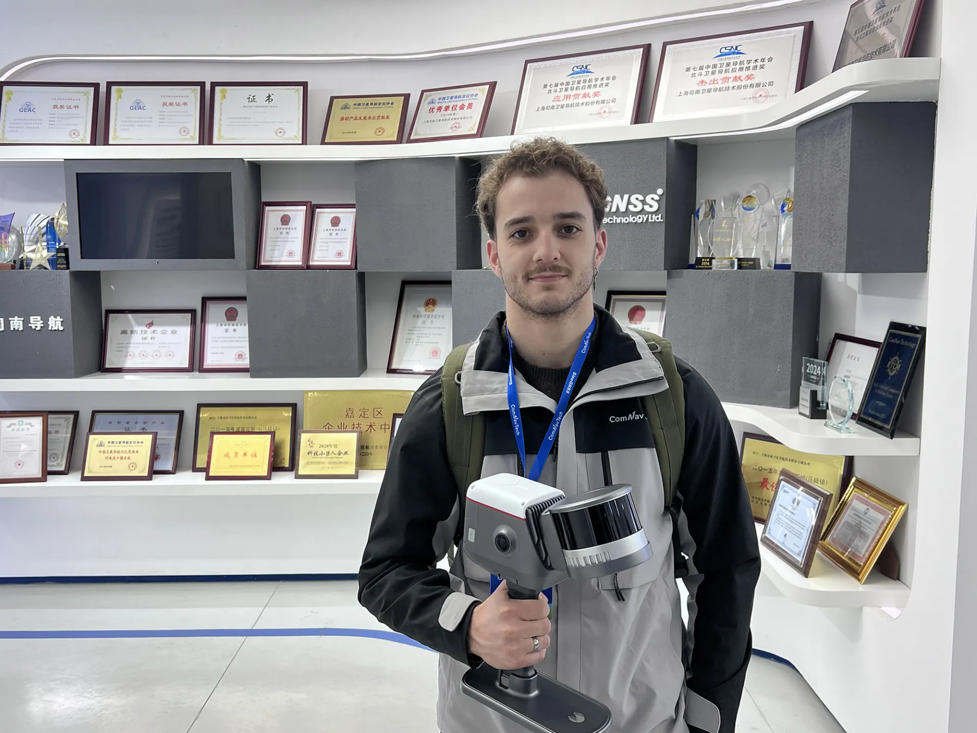
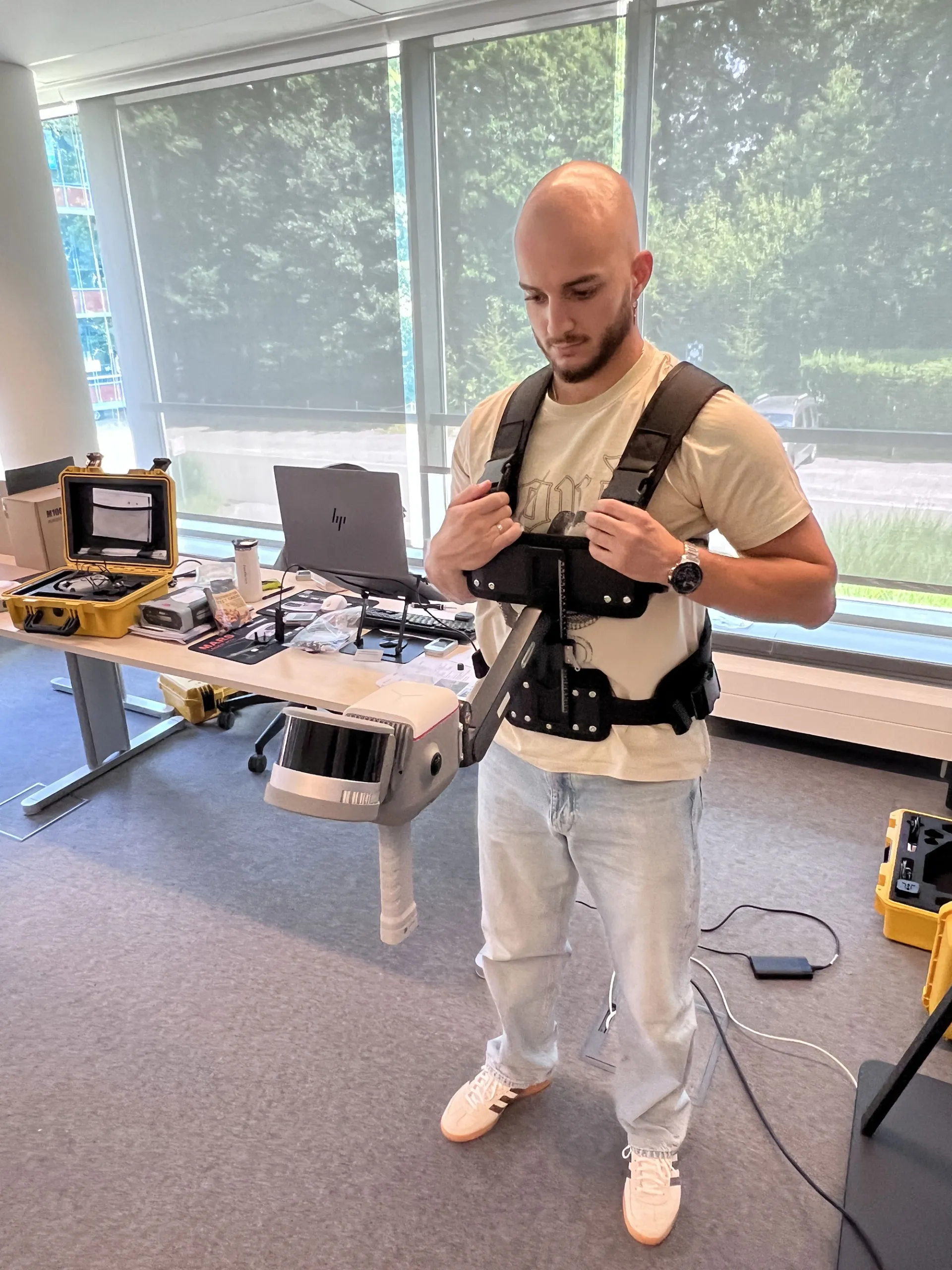
The LS600 is a next generation handheld 3D laser scanner that integrates SLAM technology, a built in RTK module for centimeter level accuracy and dual wide-angle cameras for vivid color capture. It offers fast scanning performance, simple handling and high productivity for both indoor and outdoor environments.
Key Features of the LS600
Multi Sensor Fusion and Environmental Adaptability
The LS600 integrates LiDAR, IMU, camera and GNSS chip to maintain stable performance in challenging environments. It adapts easily to indoor and outdoor projects such as low light areas, narrow passageways or urban canyons. It supports backpack and extension pole configurations to match different survey scenarios ranging from urban mapping to mining exploration.
High Precision Multi Mode Scanning
The scanner is available with 16 line or 32 line LiDAR configurations. It offers detection ranges of 120 metres or 300 meters and scan rates reaching 320000 points per second for the 16 line version or 640000 points per second for the 32 line version. The integrated RTK module supports full frequency GNSS, providing centimeter level accuracy and significantly improving field efficiency.
Dual Lens Colour Point Cloud Generation
Equipped with dual 48 MP wide angle cameras with a combined 190° field of view and enhanced by visual aided SLAM, the LS600 produces high precision color point clouds with rich detail. It supports EDL mode to improve edge clarity and provide more realistic visualization for advanced analysis.
Efficient Post Processing with Flexible Coordinate Support
With ScanMaster for Android and RealEditor for PC, the LS600 automates stitching, denoising and rendering to streamline point cloud creation. It supports UTM, Gauss Krüger and other coordinate projections, enabling direct project ready outputs and smooth integration with GIS or CAD workflows.
Technical Resources and Support
Access the LS600 technical datasheet for detailed specifications and supported accessories.
Our distributor network provides guidance, configuration support and demonstration opportunities across different regions.
Explore All 3D and Mapping Solutions
ComNav Technology offers a full ecosystem of GNSS receivers, handheld scanners and dedicated software tools designed to support accurate and efficient mapping workflows.
If you need advice on the ideal configuration for your projects, our team can assist you at every step.