Slope Stability Monitoring Solution
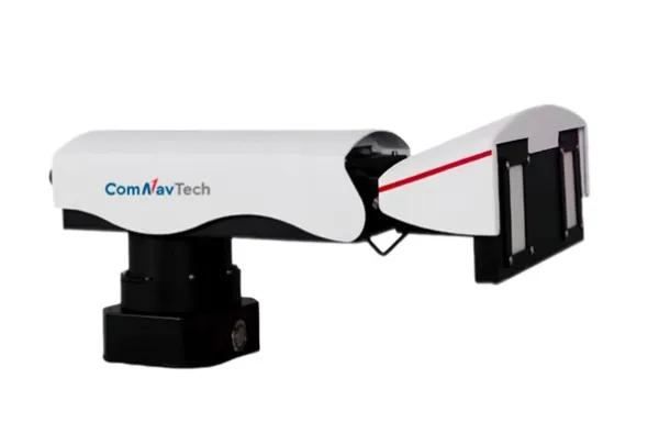
Advanced Radar Technology for Slope Monitoring
The MS Series is an advanced slope stability monitoring radar developed by ComNav Technology. Based on Synthetic Aperture Radar imaging and interferometric/differential techniques, it enables periodic inspections and targeted observations in geohazard areas, water conservancy projects, railways, highways and other key infrastructures.
The series includes three models designed for different operational needs
Monitoring Software
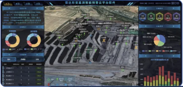
Monitoring Intelligent Alert Cloud Platform
The Monitoring Intelligent Alert Cloud Platform is designed specifically for slope stability monitoring radar. Built on a B/S architecture, it supports simultaneous online operation for multiple users and reinforces collaborative monitoring. Its interface is intuitive and can integrate with other software platforms to streamline data sharing and interoperability.
Users benefit from a stable environment supported by technical assistance, ensuring effective use of all monitoring and analysis capabilities. The cloud based approach enhances situational awareness and enables timely decision making in risk scenarios.
Solution Schematic Diagram
Advantages
Surface Coverage Perception Monitoring
Traditional point based deformation monitoring is limited in coverage and accuracy. Ground based arc SAR technology delivers long distance, wide area and 360 degree surface monitoring in all weather conditions.
High Cost Effectiveness for Slope Monitoring
A single MS Series radar can cover a large area, which significantly reduces installation and maintenance costs compared to conventional contact based monitoring equipment.
Why Choose ComNav Technology for Slope Monitoring
ComNav Technology delivers reliable monitoring solutions that combine advanced SAR imaging, precise deformation detection and professional cloud-based management tools. Our systems support real time alerts, long term measurement stability and efficient deployment in challenging environments. Engineering teams gain a complete monitoring workflow from data acquisition to intelligent analysis, supported by technical assistance and scalable system upgrades.
Explore All Monitoring Solutions
Looking to deploy a complete monitoring setup for critical infrastructure
ComNav Technology provides GNSS and radar-based monitoring systems designed for real time deformation tracking and long-term safety supervision.
Our team can assist you in selecting the best configuration for your site.